Collaborative Science for Healthy Wetlands
Featured news posts
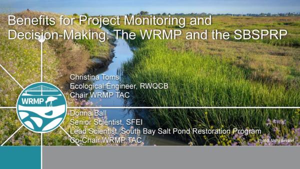
South Bay Salt Pond Restoration Project Lunch and Learn on the WRMP
The South Bay Salt Pond Restoration Project held a Lunch & Learn presentation on the WRMP in June 2025. Click here to watch the recording on their website!
Summer 2025 Newsletter
The Summer 2025 newsletter shares new reports on tidal marsh extent and wetland condition, a tidal wetland restoration data layer, monitoring updates, information on wetland education and workforce development programming, and more!
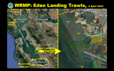
OG Fish Lab Blog Post: WRMP Eden Landing Trawls
Read a blog post from the Otolith Geochemistry & Fish Ecology Laboratory (OG Fish Lab) at UC Davis, highlighting the WRMP Eden Landing fish trawls.
Tidal Marsh Extent Webinar
The WRMP held a webinar on April 16, 2025 to discuss how we answered the question: How much tidal wetland do we have in San Francisco Bay? Watch the recording here.
About the WRMP
The San Francisco Estuary restoration community is working rapidly to protect and restore wetlands that can provide flood protection, recreation, water quality improvement, and habitat for surrounding communities. In order to meet a regional target of 100,000 acres of healthy wetlands by 2030 (Baylands Ecosystem Habitat Goals, 1999), close coordination is needed between land managers, scientists and regulators. The WRMP will improve wetland restoration project success by putting in place regional-scale monitoring increasing the impact, utility and application of permit-driven monitoring to inform science-based decision-making. Once in place, the WRMP will be a robust, science-driven, collaborative regional monitoring program that includes:
- Monitoring site network
- Open data sharing platform
- Comprehensive science framework
Our Mission
The WRMP delivers coordinated regional monitoring of the San Francisco Estuary’s wetlands to:
- Inform science-based decision-making for wetland restoration and adaptive management, and
- Increase the cost-effectiveness of permit-driven monitoring associated with wetland restoration projects.
")
Why Regional Monitoring?
- Supports effort to meet 100,000 acre healthy wetlands goal
- Supports climate change adaptation and priority responses at regional scale
- Informs and potentially facilitates project specific monitoring
- Supports project design and adaptive management via centralized data management and analysis