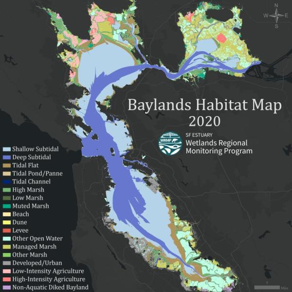
Introducing the Baylands Habitat Map 2020! Part 1
The WRMP held a webinar on October 15, 2024 to introduce the 2020 Baylands Habitat Map. Materials from the webinar are below:

Watch the Recording:
About the Baylands Habitat Map:
The Baylands Habitat Map 2020 (BHM 2020) provides updated mapping of tidal habitats and diked baylands in the San Francisco Bay Area. The Wetlands Regional Monitoring Program is offering a series of webinars to learn how to use this powerful tool and the possibilities for regional analyses to support decision-making about wetland restoration, permitting, and management. This webinar will provide a broad overview and orientation to the Baylands Habitat Map, including what it is, how to access it, and how it can be used to generate critical information to support decision-making about the region’s wetlands.
Funded by the US EPA Water Quality Improvement Fund, the BHM 2020 uses innovative automated mapping approaches that lay the groundwork for consistent mapping and change detection for years to come. The Baylands Habitat Map can be viewed in EcoAtlas’ visualization tools here.
The BHM 2020 is a useful tool for:
- Tracking habitat changes and progress towards restoration goals.
- Assessing tidal marsh extent, patch size, and connectivity.
- Analyzing how ecosystems respond to climate change, urbanization, restoration, and shoreline adaptation.
- Identifying vulnerable habitats in the face of sea level rise.
- And much more!
Speaker Bios:
Cristina Grosso: Cristina Grosso is the Managing Director for the Environmental Informatics Program at the San Francisco Estuary Institute. She manages the overall development of the EcoAtlas toolset that integrates wetlands and coastal habitats mapping, tracks restoration progress, and visualizes regional environmental data.
Alex Braud: Alex Braud is a GIS Specialist and Environmental Scientist working across the Environmental Informatics and Resilient Landscapes programs at the San Francisco Estuary Institute. His background reflects this position, intersecting the fields of spatial analysis, coastal resilience, floodplain management, environmental economics, and urban planning.
April Robinson: April Robinson is a Senior Scientist in the Resilient Landscapes Program at the San Francisco Estuary Institute. April’s expertise is in wetland ecology. She has many years experience working on projects throughout the San Francisco Estuary.
Connect with the WRMP
Join our newsletter to get updates on the WRMP, including release of new monitoring protocols, datasets, and information products. Our existing monitoring protocols (standard operating procedures, “SOPs”) can be found on our Resources page.
