Collaborative Science for Healthy Wetlands
Featured news posts
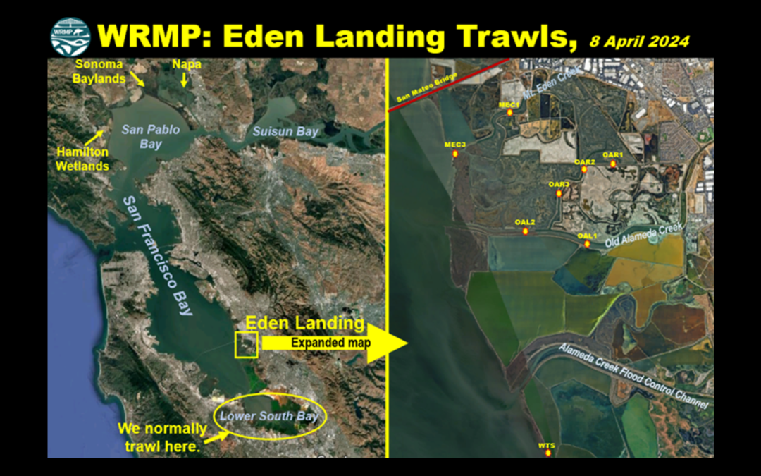
OG Fish Lab Blog Post: WRMP Eden Landing Trawls
Read a blog post from the Otolith Geochemistry & Fish Ecology Laboratory (OG Fish Lab) at UC Davis, highlighting the WRMP Eden Landing fish trawls.
WRMP Featured in KneeDeepTimes
Read a new KneeDeepTimes article about the WRMP: “Collecting and Unifying Regional Metrics on Wetland Health.”
Winter 2024 Newsletter
The Winter 2024 newsletter highlights progress on the WRMP Birds Workgroup, surface elevation table monitoring, Bay-Delta coordination, and more!
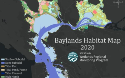
Introducing the Baylands Habitat Map 2020! Part 1
The Baylands Habitat Map 2020 (BHM 2020) provides updated mapping of tidal habitats and diked baylands in the SF Bay Area. View the recording and materials from a webinar about how to use this tool and the possibilities for regional analyses to support decision-making.
About the WRMP
The San Francisco Estuary restoration community is working rapidly to protect and restore wetlands that can provide flood protection, recreation, water quality improvement, and habitat for surrounding communities. In order to meet a regional target of 100,000 acres of healthy wetlands by 2030 (Baylands Ecosystem Habitat Goals, 1999), close coordination is needed between land managers, scientists and regulators. The WRMP will improve wetland restoration project success by putting in place regional-scale monitoring increasing the impact, utility and application of permit-driven monitoring to inform science-based decision-making. Once in place, the WRMP will be a robust, science-driven, collaborative regional monitoring program that includes:
- Monitoring site network
- Open data sharing platform
- Comprehensive science framework
Our Mission
The WRMP delivers coordinated regional monitoring of the San Francisco Estuary’s wetlands to:
- Inform science-based decision-making for wetland restoration and adaptive management, and
- Increase the cost-effectiveness of permit-driven monitoring associated with wetland restoration projects.
")
Why Regional Monitoring?
- Supports effort to meet 100,000 acre healthy wetlands goal
- Supports climate change adaptation and priority responses at regional scale
- Informs and potentially facilitates project specific monitoring
- Supports project design and adaptive management via centralized data management and analysis