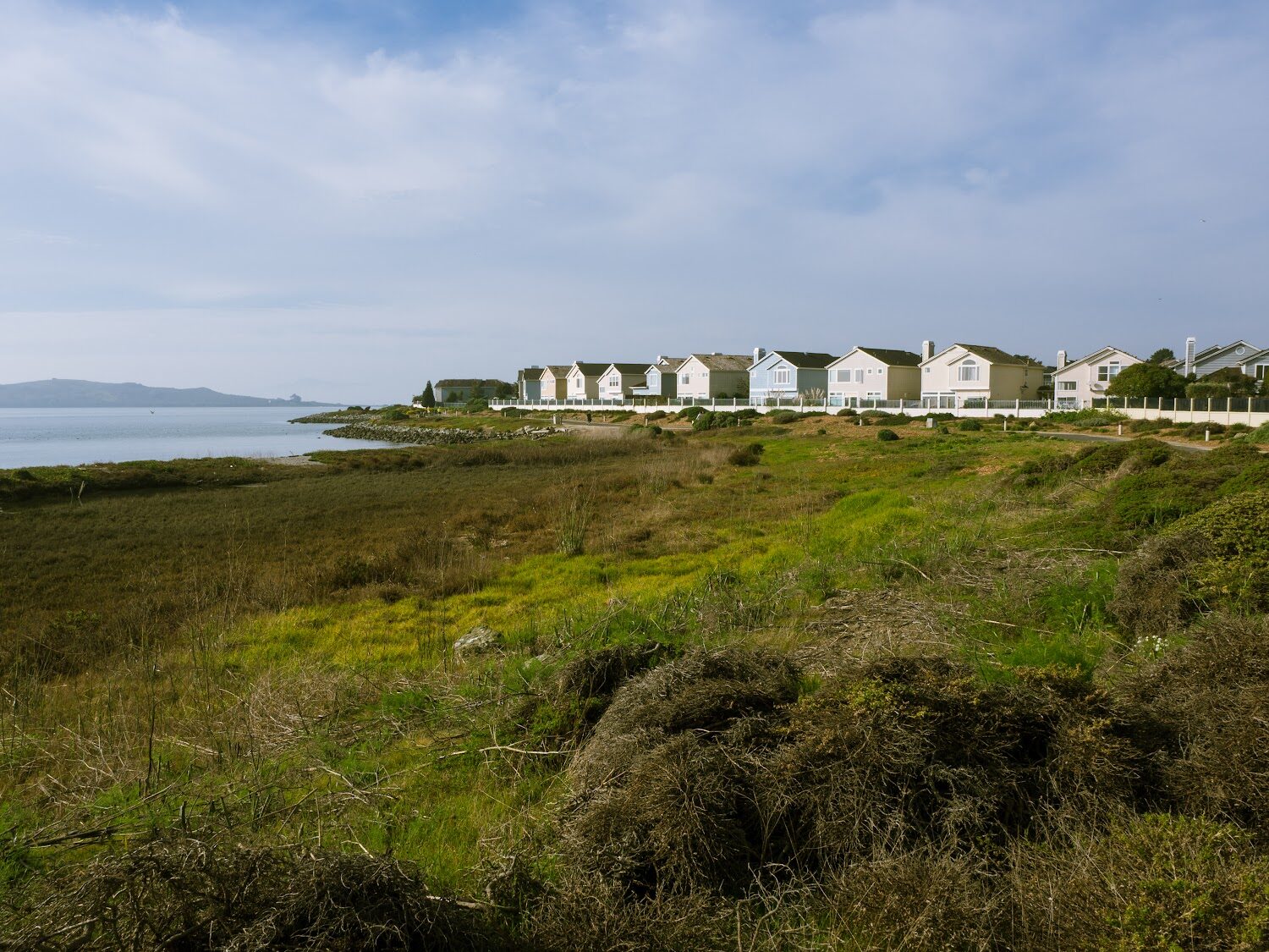
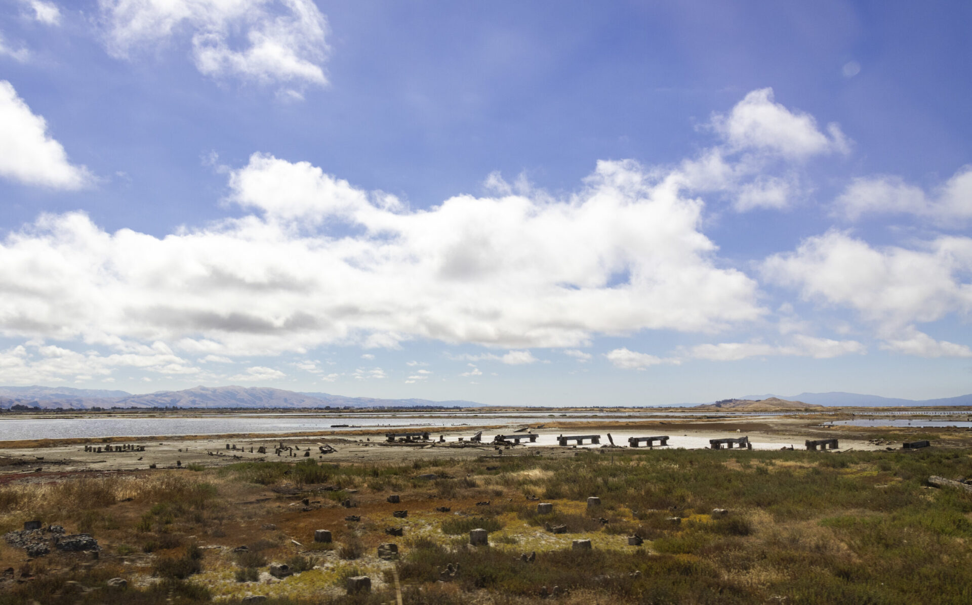
Where are our wetlands?
Tidal wetlands ringed most of the Bay prior to the mid-1800s. By 1998, more than 80% of wetlands had been lost to development. Today the WRMP tracks progress towards protecting and restoring remaining wetlands around the Bay.

Baylands Geography

Wetlands & Sea Level Rise
How healthy are our wetlands?
Wetlands with clean water and healthy habitats offer more benefits to people and wildlife and are resilient to environmental hazards.

Wetland Condition

Water Quality
Who uses our wetlands?
Tidal wetlands provide habitat for fish, wildlife, and plants, recreational opportunities for people, and environmental benefits to nearby communities.

Fish & Wildlife

Plants

People
Collaborative Science for Healthy Wetlands
Where are our wetlands?
Tidal wetlands ringed most of the Bay prior to the mid-1800s. By 1998, more than 80% of wetlands had been lost to development – today the WRMP tracks progress towards protecting and restoring remaining wetlands around the Bay.

Baylands Geography
Wetlands & Sea Level Rise
How healthy are our wetlands?
Wetlands with clean water and high habitat values offer more benefits to people and wildlife and are resilient to environmental hazards.
Wetland Condition
Water Quality
Who uses our wetlands?
Tidal wetlands provide habitat for fish, wildlife, and plants, recreational opportunities for people, and environmental benefits to nearby communities.
Fish & Wildlife
Plant Communities
People & Wetlands
What we do
The WRMP improves wetland restoration project success and cost-effectiveness by implementing coordinated environmental monitoring across the region. The Program communicates scientific results to wetland managers, regulators, community members, and funders to enable adaptive management for healthy wetlands.
Our mission
The Wetlands Regional Monitoring Program (WRMP) delivers coordinated regional monitoring of the San Francisco Estuary’s wetlands to:
-
- Inform science-based decision-making for wetland restoration and adaptive management, and
- Increase the cost-effectiveness of permit-driven monitoring associated with wetland restoration projects.
Learn More
Approach to partnership
WRMP implementation relies on collaboration with cities, counties, non-profits, Tribes, regulators, and restoration experts. The WRMP is committed to fostering partnerships with these groups to ensure all residents benefit from healthy tidal wetlands. This approach shapes all aspects of the WRMP including its operations and communication products.
Learn More
What we do
The WRMP improves wetland restoration project success and cost-effectiveness by implementing coordinated environmental monitoring across the region. The Program communicates scientific results to wetland managers, regulators, community members, and funders to enable adaptive management for healthy wetlands.
Our mission
The Wetlands Regional Monitoring Program (WRMP) delivers coordinated regional monitoring of the San Francisco Estuary’s wetlands to:
-
- Inform science-based decision-making for wetland restoration and adaptive management, and
- Increase the cost-effectiveness of permit-driven monitoring associated with wetland restoration projects.
Learn More
1
Open Data Sharing Platform
WRMP monitoring results are available to the public. This allows Bay Area residents, organizations, and local governments to leverage scientific data to respond and adapt to environmental hazards and coastal flooding.
Key Links:
Monitoring Results
Metrics
EcoAtlas
Geospatial Data Catalog
2
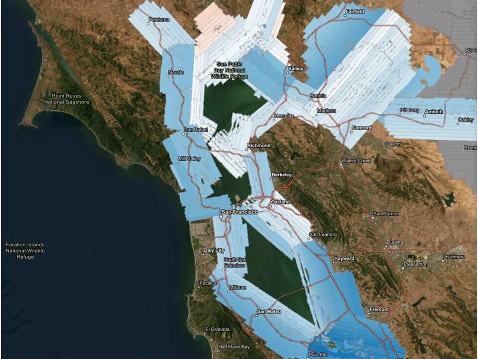
Monitoring Site Network
The WRMP monitors three types of wetlands around the Bay: 1) mature, historic wetlands; 2) mid- to late-stage restored wetlands; and 3) recently restored wetlands. These three types offer insight about wetland evolution following restoration to inform future restoration and management.
Key Links:
Monitoring Site Network
Monitoring Matrix
")
Approach to partnership
WRMP implementation relies on collaboration with cities, counties, non-profits, Tribes, regulators, and restoration experts. The WRMP is committed to fostering partnerships with these groups to ensure all residents benefit from healthy tidal wetlands. This approach shapes all aspects of the WRMP including its operations and communication products.
Learn More
3
Comprehensive Science Framework
The WRMP’s monitoring is guided by a set of practical questions that will enable better management decisions that support healthier wetlands and a more resilient Estuary. All of the WRMP’s monitoring is designed to answer these questions.
Key Links:
Science Framework
Resources
1
Open Data Sharing Platform
WRMP monitoring results are available to the public. This allows Bay Area residents, organizations, and local governments to leverage scientific data to respond and adapt to environmental hazards and coastal flooding.
Key Links:
Monitoring Results
Metrics
EcoAtlas
Geospatial Data Catalog
2
Monitoring Site Network
The WRMP monitors three types of wetlands around the Bay: 1) mature, historic wetlands; 2) mid- to late-stage restored wetlands; and 3) recently restored wetlands. These three types offer insight about wetland evolution following restoration to inform future restoration and management.
Key Links:
Monitoring Site Network
Monitoring Matrix
3
Comprehensive Science Framework
The WRMP’s monitoring is guided by a set of practical questions that will enable better management decisions that support healthier wetlands and a more resilient Estuary. All of the WRMP’s monitoring is designed to answer these questions.
Key Links:
Science Framework
Resources
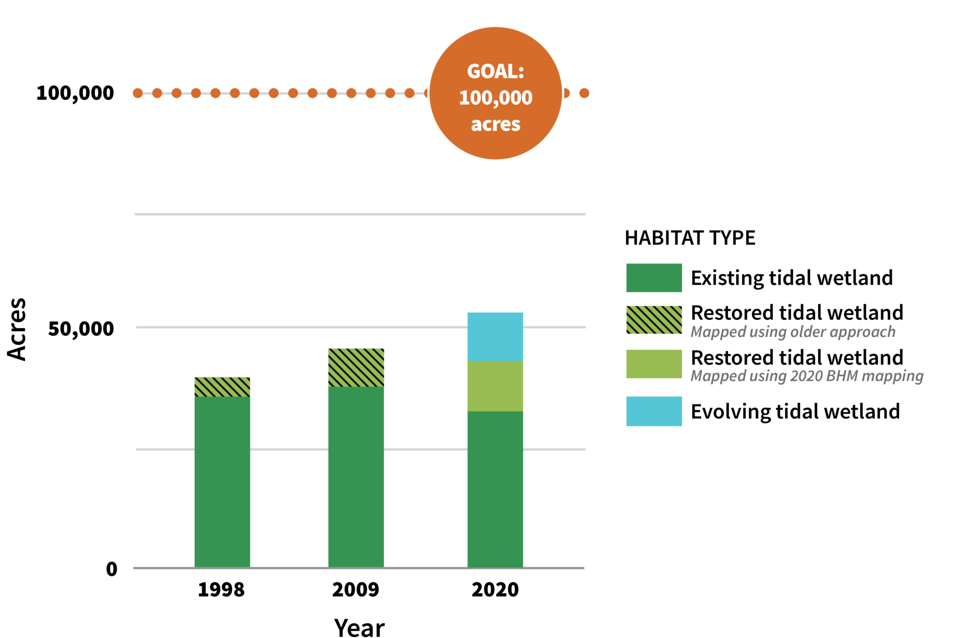
Featured Metric
Tidal Wetland Extent
Change in Bay-wide tidal wetland extent
Key Links:
Read our news story
View map on EcoAtlas
Recent news
The Latest from the WRMP
About us
Our funders & partners
The WRMP is supported by a network of funders and partners, including government agencies, research institutions, and nonprofit organizations, who collaborate to advance wetland science, restoration, and resilience in the San Francisco Estuary.


